2023 Map of Johnstown
USGS Topo · Published 2023About this map
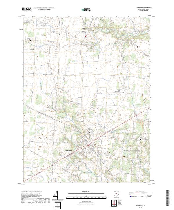
Johnstown serves as the primary hub in this portion of Licking County, situated at the intersection of several regional routes including the Johnstown-Utica Rd NW and Johnstown-Alexandria Rd. The landscape is defined by the drainage patterns of Raccoon Creek, Lobdell Creek, and Otter Fork Licking River, which weave through a mix of agricultural plots and small clusters of development. To the north, the village of Croton, also identified as Hartford, marks a distinct secondary settlement center near the Hartford Cem.
Find a feature on this map
95 named features on this map. Tap any name to fly to it.
Don’t see what you’re looking for? This feature index may not catch every label — zoom into the map to look around manually.
Map Details
Editions of this 2023 Johnstown Map
This is the sole edition of this map. No revisions or reprints were ever made.
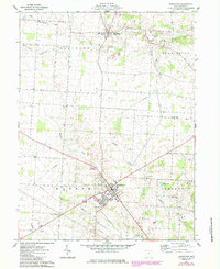
Historical Maps of Monroe Township Through Time
Featured Locations
- Jersey Township, OH
- Liberty Township, OH
- Bennington Township, OH
- Hartford Township, OH
- Johnstown, Monroe Township