2024 Map of Joiner
USGS Topo · Published 2024About this map
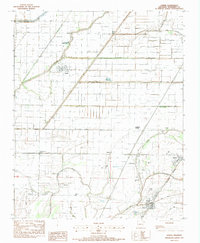
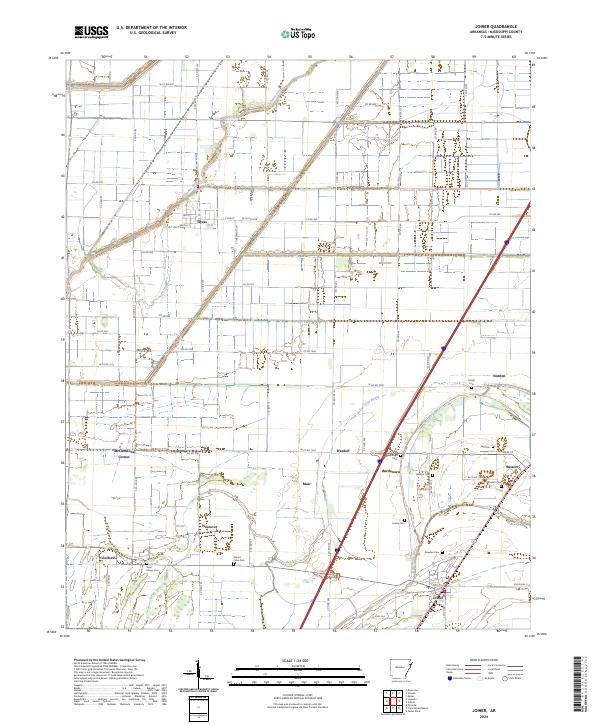
Dyess and Joiner anchor this survey of the Mississippi County landscape, where the agricultural geometry of the Arkansas Delta is defined by an intricate network of drainage canals and historic watercourses. The Tyronza River winds through the northwestern corner, while the Frenchmans Bayou and Cross Bayou cut across the southern reaches near Chelford and Westover. This modern record reveals a territory dotted with small family and community burial grounds, including the Mount Pisby Cem, Ashburn Cem, and Saint Marys Cem, which serve as vital markers for local genealogical research. The map also captures several smaller named locales such as Bardstown, Wardell, and McClendons Corner, illustrating the persistent footprint of dispersed rural settlements even as contemporary transportation corridors like Interstate 55 now dominate the north-south transit through the region.
Find a feature on this map
67 named features on this map. Tap any name to fly to it.
Don’t see what you’re looking for? This feature index may not catch every label — zoom into the map to look around manually.
Map Details
Editions of this 2024 Joiner Map
This is the sole edition of this map. No revisions or reprints were ever made.