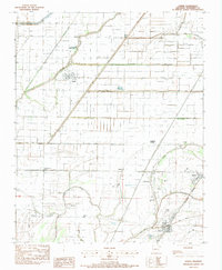
1983 Map of Joiner
USGS Topo · Published 1984About this map
Joiner and the surrounding agricultural bottomlands of Mississippi County are defined by a complex network of man-made drainage systems. The landscape is heavily engineered to support cotton and soybean farming, featuring an extensive grid of numbered canals including Ditch No 1, Ditch No 40, and Ditch No 50. These canals intersect with natural watercourses like the Tyronza River and a winding Bayou, illustrating the intensive land reclamation efforts in this part of the Delta.
Find a feature on this map
39 named features on this map. Tap any name to fly to it.
Don’t see what you’re looking for? This feature index may not catch every label — zoom into the map to look around manually.
Map Details
Editions of this 1983 Joiner Map
This is the sole edition of this map. No revisions or reprints were ever made.
Other maps of this area

1931 · Jericho
USGS Topo · 1:62,500

1939 · Jericho
USGS Topo · 1:62,500

1939 · Evadale
USGS Topo · 1:62,500

1940 · Deckerville
USGS Topo · 1:62,500

1941 · Marked Tree
USGS Topo · 1:62,500

1952 · Jericho
USGS Topo · 1:62,500

1953 · Memphis
USGS Topo · 1:250,000

1956 · Evadale
USGS Topo · 1:62,500

1956 · Marked Tree
USGS Topo · 1:62,500

1956 · Memphis
USGS Topo · 1:250,000