
Historical Maps of Arkansas
What stories do these 3,111 old maps tell about Arkansas's past? From 1879 to present day, these maps reveal the evolution of streets, neighborhoods, iconic landmarks, and natural features in stunning high-res detail. Whether you're a history enthusiast, genealogist, or professional in education, environmental work, or architecture, these maps are perfect for exploration, research, and discovery.
Discover Arkansas's history through maps:
- Trace Arkansas's growth: Explore earlier and latest maps and editions to uncover how the region changed over time.
- Examine technical details: Each map includes its creators, publishers, scale, dimensions, and full source information.
- Layer maps with modern tools & imagery: Compare historical maps to modern-day with high-resolution satellite imagery and detailed LiDAR layers.
- Sourced from trusted archives: Carefully preserved and digitized by institutions like the United Stated Geological Survey and the US Library of Congress.
- Access in any format: View and explore in high resolution, download for offline use, or order a museum-quality print for yourself or a loved one.
Begin your journey into Arkansas's history with these remarkable must-see maps.
Arkansas maps
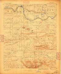
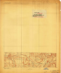
(3,111)- 1879 Map of Poteau Mountain
 1879 Poteau Mountain1879 Print · USGSCovers Arkansas, including Waldron, Evening Shade, and other nearby areas
 - 1879 Map of Cravens
 1879 Cravens1879 Print · USGSCovers Arkansas, including Ozark, Wiederkehr Village, and other nearby areas
 - 1879 Map of Fort Smith
 1879 Fort Smith1879 Print · USGSCovers Arkansas, including Fort Smith, Van Buren, and other nearby areas
 - 1879 Map of Mountain Home
 1879 Mountain Home1879 Print · USGSCovers Arkansas, including Havana, Blue Mountain, and other nearby areas
 - 1879 Map of Washington
 1879 Washington1879 Print · USGSCovers Arkansas, including Lost Corner, Raspberry, and other nearby areas
 - 1887 Map of Poteau Mountain #1
 1887 Poteau Mountain #11887 Print · USGSCovers Arkansas, including Waldron, Evening Shade, and other nearby areas
 - 1887 Map of Magazine Mountain #1
 1887 Magazine Mountain #11887 Print · USGSCovers Arkansas, including Clarksville, Paris, and other nearby areas
 - 1887 Map of Van Buren
 1887 Van Buren1887 Print · USGSCovers Arkansas, including Fort Smith, Van Buren, and other nearby areas
 - 1887 Map of Smyrna
 1887 Smyrna1887 Print · USGSCovers Arkansas, including Lost Corner, Raspberry, and other nearby areas
 - 1887 Map of Magazine Mountain #4
 1887 Magazine Mountain #41887 Print · USGSCovers Arkansas, including Havana, Blue Mountain, and other nearby areas
 - 1887 Map of Mount Ida #2
 1887 Mount Ida #21887 Print · USGSCovers Arkansas, including Cedar Creek, Olio, and other nearby areas
 - 1887 Map of Magazine Mountain #2
 1887 Magazine Mountain #21887 Print · USGSCovers Arkansas, including Ozark, Paris, and other nearby areas
 - 1887 Map of Magazine Mountain #3
 1887 Magazine Mountain #31887 Print · USGSCovers Arkansas, including Booneville, Magazine, and other nearby areas
 - 1887 Map of Watalula
 1887 Watalula1887 Print · USGSCovers Arkansas, including Ozark, Wiederkehr Village, and other nearby areas
 - 1887 Map of Magazine Mountain
 1887 Magazine Mountain1887 Print · USGSCovers Arkansas, including Havana, Blue Mountain, and other nearby areas
 - 1887 Map of Poteau Mountain #2
 1887 Poteau Mountain #21887 Print · USGSCovers Arkansas, including Puryear, Weeks, and other nearby areas
 - 1887 Map of Greenwood
 1887 Greenwood1887 Print · USGSCovers Arkansas, including Greenwood, Pocola, and other nearby areas
 - 1888 Map of Dardanelle #4
 1888 Dardanelle #41888 Print · USGSCovers Arkansas, including Russellville, Dardanelle, and other nearby areas
 - 1888 Map of Dardanelle #2
 1888 Dardanelle #21888 Print · USGSCovers Arkansas, including Clarksville, Lamar, and other nearby areas
 - 1888 Map of Dardanelle #1
 1888 Dardanelle #11888 Print · USGSCovers Arkansas, including Russellville, Dardanelle, and other nearby areas
 - 1888 Map of Dardanelle #3
 1888 Dardanelle #31888 Print · USGSCovers Arkansas, including Danville, Belleville, and other nearby areas
 - 1889 Map of Morrilton No. 3
 1889 Morrilton No. 31889 Print · USGSCovers Arkansas, including Morrilton, Atkins, and other nearby areas
 - 1889 Map of Treat
 1889 Treat1889 Print · USGSCovers Arkansas, including Bertha, Fort Douglas, and other nearby areas
 - 1889 Map of Marshall #3
 1889 Marshall #31889 Print · USGSCovers Arkansas, including Lost Corner, Raspberry, and other nearby areas
 - 1889 Map of Ozone
 1889 Ozone1889 Print · USGSCovers Arkansas, including Mount Zion, Hickory Flat, and other nearby areas
Showing maps 1-25 of 3,111
Top cities in Arkansas
- Little Rock historical maps
- Fayetteville historical maps
- Fort Smith historical maps
- Springdale historical maps
- Jonesboro historical maps
- Rogers historical maps
See more
Top counties in Arkansas
- Pulaski County historical maps
- Benton County historical maps
- Washington County historical maps
- Sebastian County historical maps
- Faulkner County historical maps
- Saline County historical maps
See more
Frequently asked questions
- What are the different types of historical maps available for Arkansas?
- What is the oldest map of Arkansas?
- Where can I purchase historical maps of Arkansas for my home or office?
- Where can I download high-res historical maps of Arkansas?
- Are there historical topographic maps available for Arkansas?
- Is there historical aerial imagery available for Arkansas?
- Where are historical maps of Arkansas sourced from?