Old Maps of Fayetteville, Arkansas
Explore 61 old maps of Fayetteville, spanning from 1898 to today. These high-resolution historic maps reveal how streets, neighborhoods, landmarks, and natural features evolved over time — perfect for genealogy, metal detecting, research, and local history exploration.
What you can do with these maps:
- See how Fayetteville changed over time: Compare historical maps to modern-day views to trace roads, homesites, rail lines & more.
- View detailed metadata: Each map includes creators, publishers, year, scale, and archive source.
- Overlay maps with satellite & LiDAR: Visualize the past alongside modern tools to explore terrain & human change.
- Trusted historical sources: Maps sourced from the USGS, Library of Congress, and other archives.
- Access maps your way: View online, download high-res files, or order prints for personal or research use.
Start exploring old maps of Fayetteville to uncover forgotten places, hidden landmarks, and the deep history beneath your feet.
Fayetteville, AR maps
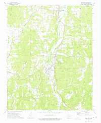
(61)- 1898 Map of Winslow, 1954 Print
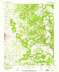
 1898 Winslow1954 Print · USGSNorthwest Arkansas and the adjacent Indian Territory are captured here in the late nineteenth century as the railroad began to transform the high Ozarks. Genealogists can trace early homesteads and transport routes like the Quesenbury Road, Rheas Mill, and the mountain town of Winslow.
 - 1899 Map of Fayetteville, 1954 Print
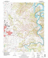
 1899 Fayetteville1954 Print · USGSNorthwest Arkansas at the close of the nineteenth century was a land of expanding railroads and deep-rooted Civil War history. Genealogists and historians can trace the foundations of the Ozarks through landmarks like the Pea Ridge Battlefield, Rheas Mill, and the early rail stops at Avoca and Lowell.
 - 1901 Map of Winslow
 1901 Winslow1901 Print · USGSThe Boston Mountains and the Arkansas border are captured here at the close of the nineteenth century, documenting the critical rail passage through the Ozarks. Genealogists and historians can trace the Frisco Line, the historic Old Wire Road, and early settlements like Cove City and Cane Hill.5 unique versions available
 - 1901 Map of Fayetteville
 1901 Fayetteville1901 Print · USGSNorthwest Arkansas is seen here at the start of the twentieth century as railroads and trade began to reshape the Ozark foothills. Researchers can locate the Pea Ridge Battlefield and Elkhorn Tavern, or trace early industrial sites like Osage Mills and Rhea's Mill.4 unique versions available
 - 1904 Map of Fayetteville
 1904 Fayetteville1904 Print · USGSNorthwest Arkansas was a land of emerging railroads and Civil War memory at the turn of the century. Genealogists can locate family homesteads near Rhea's Mill, the Pea Ridge Battlefield, and early river crossings like Vanwinkle Ferry.
 - 1946 Map of Fort Smith
 1946 Fort Smith1946 Print · USGSThe Arkansas-Oklahoma borderlands appear here in the mid-forties, as new reservoirs began to transform the river valleys. Genealogists and historians can trace rail-served towns from Muskogee to Fort Smith and locate landmarks like Camp Chaffee.
 - 1954 Map of Tulsa
 1954 Tulsa1954 Print · USGSNortheast Oklahoma and the Ozark border are shown here during a period of massive industrial and infrastructure growth. Researchers can trace the legacy of the Tri-State Mining District and the development of major reservoirs like Grand Lake O' The Cherokees.2 unique versions available
 - 1958 Map of Sonora, 1959 Print
 1958 Sonora1959 Print · USGSNorthwest Arkansas was entering a period of significant growth in the late fifties, as the borders of Springdale pushed toward the river bluffs. Researchers can trace ancestral locations through numerous rural landmarks like Accident Sch, Southern Grove Ch, and Nells Bluff Ford.4 unique versions available
 - 1958 Map of Fayetteville, 1959 Print
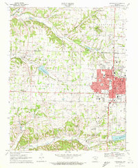
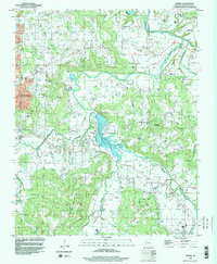
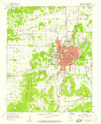 1958 Fayetteville1959 Print · USGSFayetteville was established as a major university town and rail hub in the late fifties, anchored by the University of Arkansas. Genealogists and historians can trace numerous family plots and institutions, from the National Cem to rural outposts like Salem Ch and Appleby.4 unique versions available
 - 1958 Map of Elkins, 1959 Print
 1958 Elkins1959 Print · USGSThe White River valley in the late fifties is captured here at a time of established rural communities and family-run farmsteads. Researchers can locate many ancestral sites like St Joseph Cem, Buckner Ch, and the settlement of Baldwin.3 unique versions available
 - 1958 Map of Tulsa, 1968 Print
 1958 Tulsa1968 Print · USGSNortheast Oklahoma and the Ozark borderlands are captured here during a massive era of reservoir construction and highway expansion. Researchers can trace the mid-century footprints of Tulsa, the sprawling Lake O' the Cherokees, and historical sites like Pea Ridge National Military Park.3 unique versions available
 - 1963 Map of Tulsa
 1963 Tulsa1963 Print · USGSThe Oklahoma and Arkansas borderlands are shown here in the early sixties, a time of massive reservoir construction and heavy mining. Genealogists can trace family roots through settlements like Nowata, Pryor, and Jay, or locate historical zinc and lead mines and coal mines.
 - 1965 Map of Fort Smith
 1965 Fort Smith1965 Print · USGSEastern Oklahoma and Western Arkansas are captured here during a period of massive post-war change as new reservoirs reshaped the river valleys. Genealogists and historians can trace the rail networks of the Midland Valley RR and find established communities like Stilwell, Sallisaw, and Stigler.
 - 1967 Map of Fort Smith
 1967 Fort Smith1967 Print · USGSThe Arkansas River valley and the foothills of the Ozarks are captured here during a period of significant military and industrial activity. Researchers can trace the sprawling bounds of Camp Chaffee and Camp Gruber or locate vanished rail stops along the Midland Valley RR.
 - 1970 Map of Wheeler, 1972 Print
 1970 Wheeler1972 Print · USGSNorthwest Arkansas was a mix of developing townships and forest preserves in the early seventies. You can trace the Old Railroad Grade through the hills or locate family sites near Bell Cem, Savoy, and the University of Arkansas Experimental Farm.4 unique versions available
 - 1970 Map of Springdale, 1972 Print
 1970 Springdale1972 Print · USGSSpringdale and its neighbors in Washington and Benton counties are captured during a period of suburban expansion in the 1970s. Genealogists and local historians can locate specific landmarks like St Joseph Cem, New Hope Ch, and the old Salem Sch.3 unique versions available
 - 1973 Map of West Fork, 1976 Print
 1973 West Fork1976 Print · USGSThe river valley south of Fayetteville comes into focus during the early 1970s, showing the Ozark landscape of West Fork and Greenland. Genealogists can trace family names and rural sites like Woolsey Cem, Friendship Ch, and Pitkin Corner.3 unique versions available
 - 1973 Map of Sulphur City, 1976 Print
 1973 Sulphur City1976 Print · USGSSulphur City and the rural hollows of Washington County are captured here in the early seventies, showing a landscape defined by the Middle Fork White River. Genealogists can trace family names at Salem Cem and Kings Cem or locate the site of Low Gap Ch.3 unique versions available
 - 1978 Map of Fort Smith, 1979 Print
 1978 Fort Smith1979 Print · USGSThe Arkansas-Oklahoma borderlands in the late seventies show a landscape shaped by massive river reservoirs and sprawling military reservations. Trace the historic rail lines of the Missouri Pacific RR and locate regional landmarks like Fort Gibson, Tenkiller Ferry Lake, and Barling.2 unique versions available
 - 1978 Map of Stilwell, 1979 Print
 1978 Stilwell1979 Print · USGSThe Oklahoma-Arkansas borderlands come alive in the late seventies, showing the transition from the Cherokee Nation hills to the Arkansas Ozarks. Researchers can trace the Kansas City Southern rail line through Stilwell, find Wrights Chapel, or locate the Northeastern State College campus in Tahlequah.
 - 1979 Map of Fayetteville, 1980 Print
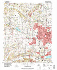
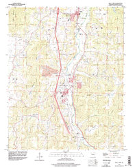
 1979 Fayetteville1980 Print · USGSNorthwest Arkansas and the tristate corner show a booming corridor of rail-linked towns and highland forests in the late seventies. Researchers can trace historic landmarks like Pea Ridge National Military Park, the Frisco RR, and the University of Arkansas.2 unique versions available
 - 1994 Map of Springdale, 1998 Print
 1994 Springdale1998 Print · USGSNorthwest Arkansas was undergoing rapid expansion in the 1990s as the urban centers of Springdale and Johnson began to merge. Researchers can trace family sites and old landmarks like Silent Grove Ch, Lake Elmdale, and the St Louis-San Francisco RR.
 - 1994 Map of Sonora, 1998 Print
 1994 Sonora1998 Print · USGSThe White River valley east of Springdale comes into focus in the mid-1990s as suburban growth meets rural Arkansas tradition. Genealogists and local historians can trace legacy sites like Accident Sch, Phillips Cem, and the small settlement of Sonora.
 - 1994 Map of Elkins, 1998 Print
 1994 Elkins1998 Print · USGSEastern Washington County appears in the mid-1990s as a landscape of river forks and mountain ridges just before significant modern expansion. Family historians can locate several historic burial grounds like Birkhead Cem and Strain Cem, or trace the rural origins of Habberton and Baldwin.
 - 1994 Map of West Fork, 1998 Print
 1994 West Fork1998 Print · USGSWest Fork and Greenland are seen here during a decade of transition in the mid-1990s as major highway construction began to reshape the river valley. Researchers can trace family history through several burial grounds and rural landmarks like Boone Cem, Woolsey Ch, and Pitkin Corner.2 unique versions available
Showing maps 1-25 of 61
Top cities near Fayetteville
- Springdale historical maps
- Rogers historical maps
- Bentonville historical maps
- Lowell historical maps
- Farmington historical maps
- Prairie Grove historical maps
See more
Top neighborhoods of Fayetteville
- Baldwin historical maps
- Fayette Junction historical maps
- White Rock historical maps
- Quarry Trace historical maps
- Candlewood historical maps
- Glenbrook Place historical maps
See more
Frequently asked questions
- What are the different types of historical maps available for Fayetteville?
- What is the oldest map of Fayetteville?
- Where can I purchase historical maps of Fayetteville for my home or office?
- Where can I download high-res historical maps of Fayetteville?
- Are there historical topographic maps available for Fayetteville?
- Is there historical aerial imagery available for Fayetteville?
- Where are historical maps of Fayetteville sourced from?