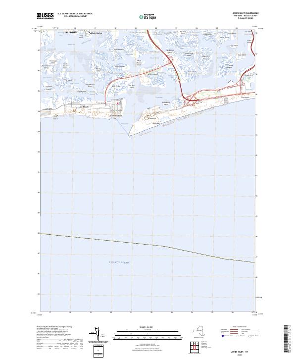
2023 Map of Jones Inlet
USGS Topo · Published 2023About this map
Hempstead Bay and the intricate salt marshes of the South Shore define this coastal landscape, where the barrier islands protect a labyrinth of tidal creeks and leads. The developed waterfronts of Lido Beach and Point Lookout stand at the edge of Jones Inlet, marking the transition from the inhabited villages of Baldwin and Baldwin Harbor to the expansive wetlands. A complex network of islands, including Meadow Island, West Crow Island, and East Island, reveals the natural geography that persists alongside major infrastructure like the Loop Pkwy and Ocean Pkwy.
Find a feature on this map
75 named features on this map. Tap any name to fly to it.
Don’t see what you’re looking for? This feature index may not catch every label — zoom into the map to look around manually.
Map Details
Editions of this 2023 Jones Inlet Map
This is the sole edition of this map. No revisions or reprints were ever made.
Other maps of this area

1897 · Hempstead
USGS Topo · 1:62,500

1898 · Hempstead
USGS Topo · 1:62,500

1899 · Hempstead
USGS Topo · 1:62,500

1901 · Babylon
USGS Topo · 1:62,500

1903 · Babylon
USGS Topo · 1:62,500

1903 · Hempstead
USGS Topo · 1:62,500

1904 · Islip
USGS Topo · 1:125,000
1919 · Babylon
USGS Topo · 1:62,500

1942 · Islip
USGS Topo · 1:125,000
1947 · Jones Inlet
USGS Topo · 1:24,000