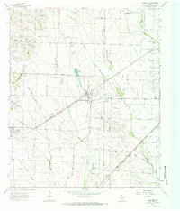
1963 Map of Josephine
USGS Topo · Published 1985About this map
The rural landscape of eastern Collin and western Hunt counties is defined by its small agricultural hubs and the diverging paths of two major rail lines. Josephine serves as a central point, situated where several local routes converge near Cooks Lake. To the southwest, Nevada anchors the corner of the map, while smaller locales like Burrow and Pleasant Valley dot the surrounding countryside. This 1963 survey captures the area before modern suburban expansion, showing a community structured around its institutions, such as the Community Sch and High Sch.
Find a feature on this map
18 named features on this map. Tap any name to fly to it.
Don’t see what you’re looking for? This feature index may not catch every label — zoom into the map to look around manually.
Map Details
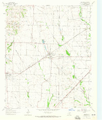
Editions of this 1963 Josephine Map
2 editions found
Other maps of this area

1912 · Rockwall
USGS Topo · 1:31,680

1919 · Royse City
USGS Topo · 1:62,500

1924 · Farmersville 3-c
USGS Topo · 1:48,000

1930 · Farmersville
USGS Topo · 1:62,500

1954 · Dallas
USGS Topo · 1:250,000

1954 · Sherman
USGS Topo · 1:250,000

1956 · Quinlan
USGS Topo · 1:62,500

1958 · Dallas
USGS Topo · 1:250,000

1958 · Sherman
USGS Topo · 1:250,000

1960 · Culleoka
USGS Topo · 1:24,000