2022 Map of Junction City
USGS Topo · Published 2022About this map
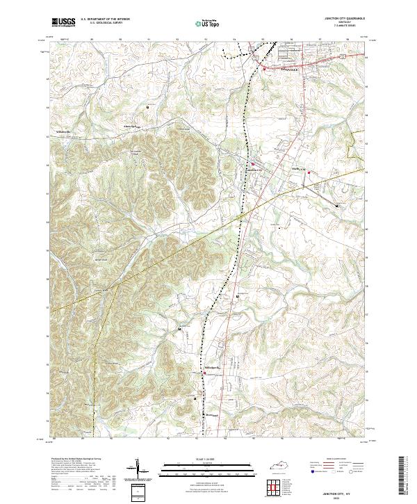
Danville and Junction City anchor this central Kentucky landscape, where the southern outskirts of the regional hub meet the rolling hills of the Knob region. The terrain is defined by a series of prominent peaks, including Boyle Knob, Catholic Knob, and Persimmon Knob, which rise significantly above the surrounding valleys. Waterways like the Salt River, Clarks Run, and Knoblick Creek weave through the countryside, framing a network of small communities such as Milledgeville, Moreland, and Alum Springs.
Find a feature on this map
46 named features on this map. Tap any name to fly to it.
Don’t see what you’re looking for? This feature index may not catch every label — zoom into the map to look around manually.
Map Details
Editions of this 2022 Junction City Map
This is the sole edition of this map. No revisions or reprints were ever made.