2022 Map of Kalona
USGS Topo · Published 2022About this map
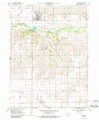
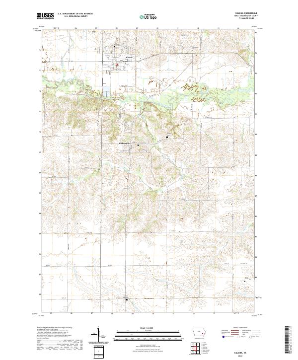
Kalona serves as the primary hub of this Washington County landscape, where the rectilinear grid of the town site meets the meandering path of the English River. The map reveals a dense concentration of rural burial grounds, including Sharon Hill Cem and Snider Cem, which offer significant data points for genealogical research in this part of Iowa. To the south, the settlement of Richmond is established near the Richmond Cem and Holy Trinity Cem, surrounded by a network of drainage systems like Camp Cr and Davis Cr. The terrain is characterized by a transition from the river valley floors to the upland plateaus, punctuated by local water features such as the Lily Pond and Bulgers Run. This modern survey maintains the historical township and range framework, preserving the legacy of 19th-century land division across t77n r8w and surrounding sections.
Find a feature on this map
66 named features on this map. Tap any name to fly to it.
Don’t see what you’re looking for? This feature index may not catch every label — zoom into the map to look around manually.
Map Details
Editions of this 2022 Kalona Map
This is the sole edition of this map. No revisions or reprints were ever made.