2023 Map of Kamas
USGS Topo · Published 2023About this map
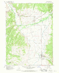
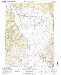
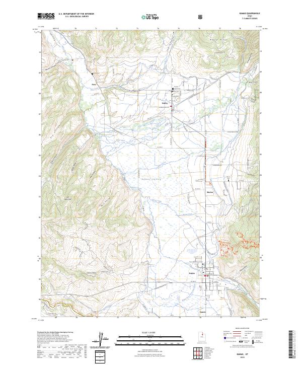
Kamas Valley serves as a fertile agricultural corridor between the Mahogany Hills and The West Hills, supporting a string of interconnected rural settlements. This modern survey illustrates the persistent importance of water management in the region, centered on the Weber River and the significant Weber Provo Diversion Canal that cuts through the landscape. The human geography is defined by a series of small towns including Kamas, Francis, Marion, Oakley, and Peoa, each maintaining its own distinct identity. For those researching local families, the map is remarkably dense with burial grounds, including the Peoa Cem, North Bench Cem, and Oakley Cem. The intricate network of local roads and trails, such as Woodenshoe LN and Cow Aly, reflects the evolution of this high-valley ranching community into its contemporary form.
Find a feature on this map
88 named features on this map. Tap any name to fly to it.
Don’t see what you’re looking for? This feature index may not catch every label — zoom into the map to look around manually.
Map Details
Editions of this 2023 Kamas Map
This is the sole edition of this map. No revisions or reprints were ever made.