2024 Map of Kampsville
USGS Topo · Published 2024About this map
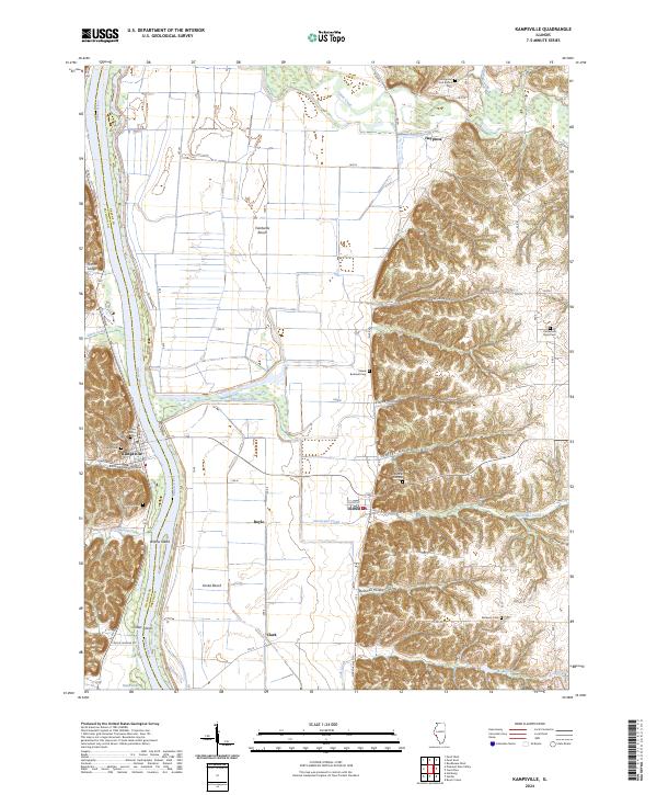
The Illinois River serves as the primary geographical divider between Calhoun and Greene counties, framing a landscape where fertile bottomlands meet the sharp relief of eastern bluffs. In the settlement of Kampsville, the local street grid including Broadway and St Charles St sits at the mouth of Kampsville Hollow, while across the water, the village of Eldred is positioned at the base of the bluff line. The eastern half of the map is defined by a series of deep drainages such as Shaffer Hollow, Eldred Hollow, and Bushnell Hollow that cut through the upland terrain.
Find a feature on this map
42 named features on this map. Tap any name to fly to it.
Don’t see what you’re looking for? This feature index may not catch every label — zoom into the map to look around manually.
Map Details
Editions of this 2024 Kampsville Map
This is the sole edition of this map. No revisions or reprints were ever made.