2023 Map of Kanawha
USGS Topo · Published 2023About this map
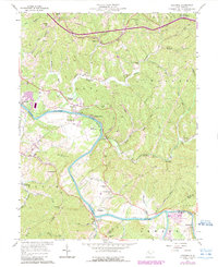
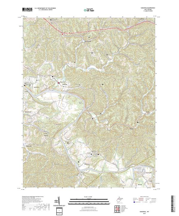
The Little Kanawha River and the Hughes River define the winding geography of Wood County, where the transition from rail to recreation is evidenced by the North Bend Rail-Trl. Small settlements such as Kanawha, Leachtown, and Walker are connected by a network of rural routes and the historic Staunton Tpke. The landscape is dotted with numerous family and community burial grounds, including the McCardel - Ross Cem, Caplinger Cem, and Vaught Chapel Cem, providing a dense record for genealogical research.
Find a feature on this map
153 named features on this map. Tap any name to fly to it.
Don’t see what you’re looking for? This feature index may not catch every label — zoom into the map to look around manually.
Map Details
Editions of this 2023 Kanawha Map
This is the sole edition of this map. No revisions or reprints were ever made.