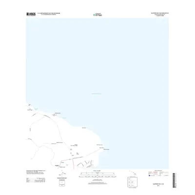
2013 Map of Kapoho OE N
USGS Topo · Published 2013About this map
Kapoho Lava Flow of 1960 and the earlier Lava Flow of 1840 dominate this coastal section of the Island of Hawai'i, illustrating the recent volcanic history of the Puna District. The shoreline is marked by prominent landmarks such as Cape Kumukahi and its namesake Cape Kumukahi Light, alongside culturally significant sites like Kukii Heiau and the Old Hawaiian Canoe Sheds near Makaukiu Point.
Find a feature on this map
33 named features on this map. Tap any name to fly to it.
Don’t see what you’re looking for? This feature index may not catch every label — zoom into the map to look around manually.
Map Details
Editions of this 2013 Kapoho OE N Map
This is the sole edition of this map. No revisions or reprints were ever made.
Other maps of this area

1924 · Makuu
USGS Topo · 1:62,500

1924 · Kalapana
USGS Topo · 1:62,500

1954 · Hawaii South
USGS Topo · 1:250,000

1954 · Hawaii North
USGS Topo · 1:250,000

1959 · Hawaii South
USGS Topo · 1:250,000

1959 · Hawaii North
USGS Topo · 1:250,000

1961 · Hawaii North
USGS Topo · 1:250,000

1961 · Hawaii South
USGS Topo · 1:250,000

1962 · Hawaii South
USGS Topo · 1:250,000
1963 · Keaau Ranch
USGS Topo · 1:24,000