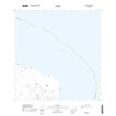
2017 Map of Kapoho OE N
USGS Topo · Published 2017About this map
Kapoho sits at the easternmost point of the Island of Hawai‘i, where volcanic history is etched into the landscape. The geography is defined by significant events, including the Lava Flow of 1840 near Nanawale Bay and the more recent Kapoho Lava Flow of 1960 that reshaped the terrain around Cape Kumukahi. These flows surround prominent volcanic features like Kapoho Crater, which contains Green Lake, and elevated cinder cones such as Puu Kukae and Puukea.
Find a feature on this map
30 named features on this map. Tap any name to fly to it.
Don’t see what you’re looking for? This feature index may not catch every label — zoom into the map to look around manually.
Map Details
Editions of this 2017 Kapoho OE N Map
This is the sole edition of this map. No revisions or reprints were ever made.
Other maps of this area

1924 · Makuu
USGS Topo · 1:62,500

1924 · Kalapana
USGS Topo · 1:62,500

1954 · Hawaii South
USGS Topo · 1:250,000

1954 · Hawaii North
USGS Topo · 1:250,000

1959 · Hawaii South
USGS Topo · 1:250,000

1959 · Hawaii North
USGS Topo · 1:250,000

1961 · Hawaii North
USGS Topo · 1:250,000

1961 · Hawaii South
USGS Topo · 1:250,000

1962 · Hawaii South
USGS Topo · 1:250,000
1963 · Keaau Ranch
USGS Topo · 1:24,000