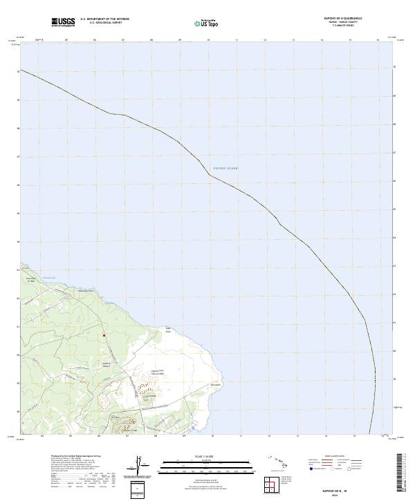
2024 Map of Kapoho OE N
USGS Topo · Published 2024About this map
Geological forces define the easternmost tip of the Island of Hawai'i, where the legacies of historical volcanic activity remain visible on the landscape. The Lava Flow of 1840 and the Kapoho Lava Flow of 1960 have permanently altered the terrain near Kumukahi, creating a complex topography of hardened flows and prominent features like Kapoho Crater. At the center of the crater, Green Lake provides a rare point of inland water, while the coastline is marked by significant formations such as Maka'ukiu Point and Sand Hill. A network of local roads, including Cinder Rd and the appropriately named Railroad Ave, provides access to these geologic sites, illustrating how modern infrastructure navigates the results of recent eruptions on the Puna coast.
Find a feature on this map
28 named features on this map. Tap any name to fly to it.
Don’t see what you’re looking for? This feature index may not catch every label — zoom into the map to look around manually.
Map Details
Editions of this 2024 Kapoho OE N Map
This is the sole edition of this map. No revisions or reprints were ever made.
Other maps of this area

1924 · Makuu
USGS Topo · 1:62,500

1924 · Kalapana
USGS Topo · 1:62,500

1954 · Hawaii South
USGS Topo · 1:250,000

1954 · Hawaii North
USGS Topo · 1:250,000

1959 · Hawaii South
USGS Topo · 1:250,000

1959 · Hawaii North
USGS Topo · 1:250,000

1961 · Hawaii North
USGS Topo · 1:250,000

1961 · Hawaii South
USGS Topo · 1:250,000

1962 · Hawaii South
USGS Topo · 1:250,000
1963 · Keaau Ranch
USGS Topo · 1:24,000