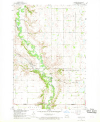
1967 Map of Kathryn
USGS Topo · Published 1969About this map
The Sheyenne River snakes through a deeply carved valley in southeastern North Dakota, anchoring a landscape defined by its glacial heritage and early rail commerce. The village of Kathryn serves as the local hub, situated where Spring Creek meets the river valley. Further north, the small settlement of Daily and the eastern station at Eastedge trace the path of the Northern Pacific railroad, which provided the vital link for the region's agricultural output.
Find a feature on this map
26 named features on this map. Tap any name to fly to it.
Don’t see what you’re looking for? This feature index may not catch every label — zoom into the map to look around manually.
Map Details
Editions of this 1967 Kathryn Map
This is the sole edition of this map. No revisions or reprints were ever made.
Other maps of this area

1897 · Tower
USGS Topo · 1:125,000

1897 · Eckelson
USGS Topo · 1:125,000

1953 · Jamestown
USGS Topo · 1:250,000

1953 · Fargo
USGS Topo · 1:250,000

1956 · Fargo
USGS Topo · 1:250,000

1956 · Jamestown
USGS Topo · 1:250,000

1967 · Ft. Ransom
USGS Topo · 1:24,000

1967 · Fingal
USGS Topo · 1:24,000

1967 · Fingal SW
USGS Topo · 1:24,000
1967 · Nome SE
USGS Topo · 1:24,000