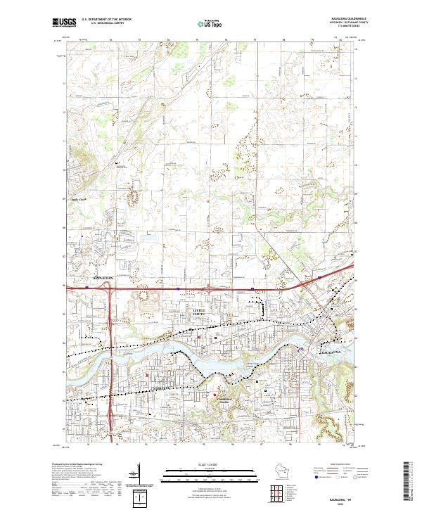
2022 Map of Kaukauna
USGS Topo · Published 2022About this map
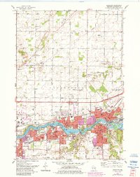
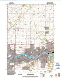
The Fox River carves a deep industrial and historical path through the heart of this Wisconsin landscape, defining the boundaries and development of Kaukauna, Little Chute, and Kimberly. The waterway is characterized by significant features like the Little Chute Islands and Fox Point, which have historically influenced the siting of mills and early power infrastructure. This modern survey illustrates how these tight-knit communities are woven together by a dense network of roads and residential growth, yet remain anchored by their spiritual and civic foundations.
Find a feature on this map
171 named features on this map. Tap any name to fly to it.
Don’t see what you’re looking for? This feature index may not catch every label — zoom into the map to look around manually.
Map Details
Editions of this 2022 Kaukauna Map
This is the sole edition of this map. No revisions or reprints were ever made.
Historical Maps of Kaukauna Through Time
3 maps found