2017 Map of Kealakekua
USGS Topo · Published 2017About this map
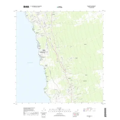
The Burial Ground for Kuamoo Battle Warriors and the ancient Haikuua Stone stand as significant cultural landmarks along the western coast of the Island of Hawai'i. This coastal corridor is traversed by the Ala Kahakai National Historic Trail, which links numerous bays and points including Heeia Bay, Keauhou Bay, and Kualanui Point. The inland landscape is defined by the steep elevation gain toward the volcanic slopes, where settlements like Hōlualoa, Honalo, and Kainaliu are situated along the historic winding route of Malahahoa Hwy. These communities reflect the region's agricultural heritage, with local roads such as Coffee Shack Rd and Donkey Mill Rd hinting at the traditional industries that have shaped the Kona district. The transition from the shoreline at Disappearing Sands Beach to the higher elevation of Puu Loa illustrates the compressed ecological zones typical of this Pacific landscape.
Find a feature on this map
96 named features on this map. Tap any name to fly to it.
Don’t see what you’re looking for? This feature index may not catch every label — zoom into the map to look around manually.
Map Details
Editions of this 2017 Kealakekua Map
This is the sole edition of this map. No revisions or reprints were ever made.
Other maps of this area

1928 · Kailua
USGS Topo · 1:62,500

1954 · Hawaii South
USGS Topo · 1:250,000

1954 · Hawaii North
USGS Topo · 1:250,000

1959 · Hawaii South
USGS Topo · 1:250,000

1959 · Hawaii North
USGS Topo · 1:250,000

1959 · Hualalai
USGS Topo · 1:24,000

1959 · Honaunau
USGS Topo · 1:24,000

1959 · Puu Lehua
USGS Topo · 1:24,000

1959 · Keahole Point
USGS Topo · 1:24,000

1959 · Kailua
USGS Topo · 1:24,000