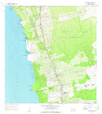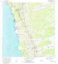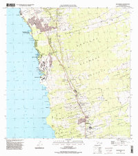
2024 Map of Kealakekua
USGS Topo · Published 2024About this map
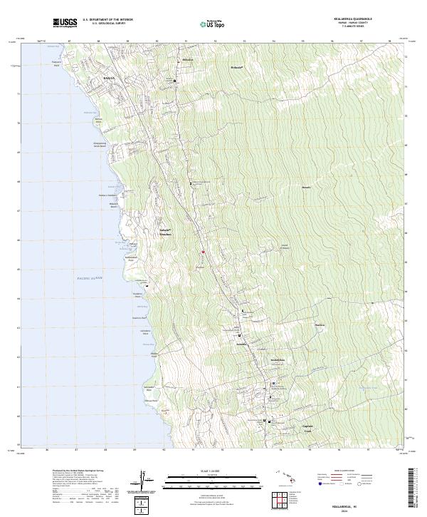
The leeward coast of the Island of Hawai‘i reveals a dense network of upland settlements and coastal landmarks along the Kona coast. Significant for local historians and genealogists, the landscape is dotted with numerous religious sites and interments, ranging from the Lekeleke Burial Grounds near the shore to the Holualoa Japanese Cem and several congregational church cemeteries such as Hekani Congregational Church Cem. The concentration of settlements like Kailua, Kealakekua, and Captain Cook follows the traditional patterns of development along the Kuakini Hwy and Hawaii Belt Rd, which trace the contours of the volcanic slopes. The coastline itself is marked by distinctive geological features, including Disappearing Sands Beach and numerous named points like Leinokano Point and Kaukalaelae Point, reflecting the deep cultural connection between the land and the Pacific Ocean.
Find a feature on this map
121 named features on this map. Tap any name to fly to it.
Don’t see what you’re looking for? This feature index may not catch every label — zoom into the map to look around manually.
Map Details
Editions of this 2024 Kealakekua Map
This is the sole edition of this map. No revisions or reprints were ever made.
Historical Maps of Kahaluu-Keauhou Through Time
5 maps found