Loading...
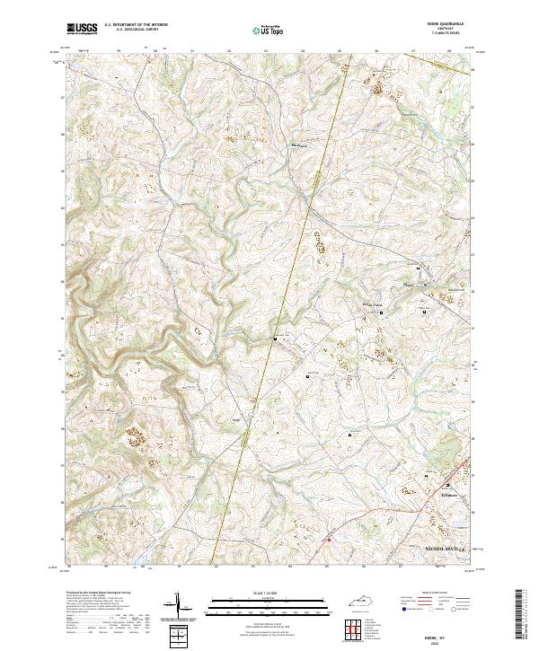
Loading map...2022 Map of Keene
USGS Topo · Published 2022About this map
Keene and Troy anchor this landscape of central Kentucky, where the headwaters of Clear Creek carve through the rolling terrain. The map documents a dense network of country roads and family-named pikes, such as Troy Pike and Delaney Ferry Rd, which connect historic clusters of settlement. This 2022 survey reveals a landscape deeply rooted in its pastoral past, preserved through numerous family and church burial grounds including the Ebenezer Cem and Saliee Cem.
Find a feature on this map
97 named features on this map. Tap any name to fly to it.
Don’t see what you’re looking for? This feature index may not catch every label — zoom into the map to look around manually.
Map Details
Date Portrayed2022
Date Published2022
PublisherU.S. Geological Survey
Map TypeTopographic
Scale1:24000
Physical Dimensions24 x 29 inches
Editions of this 2022 Keene Map
This is the sole edition of this map. No revisions or reprints were ever made.
Historical Maps of Dixon Town Through Time
Featured Locations
Source Details
SourceU.S. Geological Survey
CopyrightPublic Domain