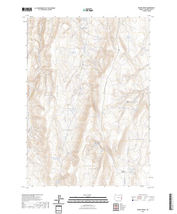
2023 Map of Keeney Ridge
USGS Topo · Published 2023About this map
Keeney Ridge and Hoodoo Ridge dominate this high-desert landscape in Malheur County, where water management is the primary marker of human presence. The terrain is characterized by a series of named basins, including Harper Basin and Freezeout Basin, each utilized for livestock or irrigation. Numerous small-scale water projects are scattered across the slopes, from the curiously named Slim and Fatty Reservoir to specifically numbered sites like Stacey Reservoir Number One and Keeney Cr Reservoir Number Four. These features, along with names like Sourdough Mtn and Freezeout Mtn, reflect the early ranching history of the Oregon interior. The map also traces essential water sources like Riley Spring and Daisy Basin Spring, which remain vital landmarks in this arid environment.
Find a feature on this map
39 named features on this map. Tap any name to fly to it.
Don’t see what you’re looking for? This feature index may not catch every label — zoom into the map to look around manually.
Map Details
Editions of this 2023 Keeney Ridge Map
This is the sole edition of this map. No revisions or reprints were ever made.
Other maps of this area

1906 · Mitchell Butte
USGS Topo · 1:125,000

1955 · Boise
USGS Topo · 1:250,000

1958 · Boise
USGS Topo · 1:250,000

1962 · Boise
USGS Topo · 1:250,000

1966 · Harper
USGS Topo · 1:62,500
1967 · Sourdough Spring
USGS Topo · 1:24,000
1967 · Kane Spring Gulch
USGS Topo · 1:24,000

1967 · Twin Springs
USGS Topo · 1:24,000

1972 · Avery Creek
USGS Topo · 1:24,000

1972 · Rufino Butte
USGS Topo · 1:24,000