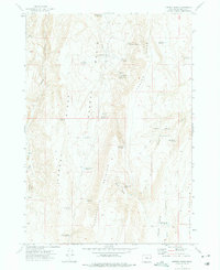
1972 Map of Keeney Ridge
USGS Topo · Published 1975About this map
Harper Basin and the surrounding high ridges define this Malheur County landscape as it appeared in the early 1970s. The topography is dominated by massive north-south formations including Hoodoo Ridge, Keeney Ridge, and Freezout Mountain. This is a terrain of essential water management for ranching, evidenced by a dense network of springs and named reservoirs such as Hog Leg Reservoir, Slim and Fatty Reservoir, and the uniquely titled Hood of Hoodoo Res.
Find a feature on this map
40 named features on this map. Tap any name to fly to it.
Don’t see what you’re looking for? This feature index may not catch every label — zoom into the map to look around manually.
Map Details
Editions of this 1972 Keeney Ridge Map
This is the sole edition of this map. No revisions or reprints were ever made.
Other maps of this area

1906 · Mitchell Butte
USGS Topo · 1:125,000

1955 · Boise
USGS Topo · 1:250,000

1958 · Boise
USGS Topo · 1:250,000

1962 · Boise
USGS Topo · 1:250,000

1966 · Harper
USGS Topo · 1:62,500
1967 · Sourdough Spring
USGS Topo · 1:24,000
1967 · Kane Spring Gulch
USGS Topo · 1:24,000

1967 · Twin Springs
USGS Topo · 1:24,000

1972 · Avery Creek
USGS Topo · 1:24,000

1972 · Rufino Butte
USGS Topo · 1:24,000