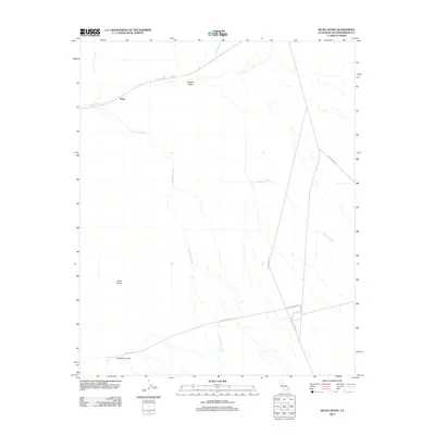
2012 Map of Kelso Dunes
USGS Topo · Published 2012About this map
Kelso Dunes dominate this stretch of the Mojave Desert, where wind and sand define the physical landscape. The northern edge of the map is marked by the Up Rr tracks, which parallel Kelso Wash as it trends toward the siding at Flynn. This transport corridor serves as the primary artery through the arid terrain, contrasted by the seasonal paths of Cottonwood Wash and Winston Wash that drain the alluvial slopes. In the southern portion of the quadrangle, the Dick Taylor Airstrip sits isolated near the junction of desert tracks. The road network, including Vulcan Mine Rd and Kelso-Amboy Rd, provides the only terrestrial links between the shifting dunes and distant mining or ranching operations. This 2012 survey reveals the sparse infrastructure required for desert transit, from rail sidings to remote landing strips, all situated within a massive system of migrating sand.
Find a feature on this map
12 named features on this map. Tap any name to fly to it.
Don’t see what you’re looking for? This feature index may not catch every label — zoom into the map to look around manually.
Map Details
Editions of this 2012 Kelso Dunes Map
This is the sole edition of this map. No revisions or reprints were ever made.
Other maps of this area

1910 · Ivanpah
USGS Topo · 1:250,000

1912 · Ivanpah
USGS Topo · 1:250,000

1942 · Ivanpah
USGS Topo · 1:250,000

1942 · Amboy
USGS Topo · 1:250,000

1943 · Amboy
USGS Topo · 1:250,000

1947 · Kingman
USGS Topo · 1:250,000

1948 · Kingman
USGS Topo · 1:250,000

1954 · Needles
USGS Topo · 1:250,000

1954 · Kingman
USGS Topo · 1:250,000

1955 · Kingman
USGS Topo · 1:250,000