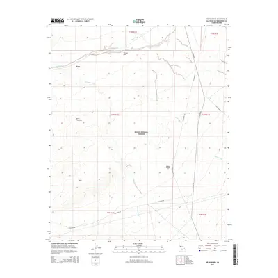
2015 Map of Kelso Dunes
USGS Topo · Published 2015About this map
Kelso Dunes dominates this portion of the eastern California landscape, where shifting sands and arid drainage patterns define the geography of the Mojave National Preserve. The settlement of Flynn stands as a lonely human outpost along the northern rail corridor, while the evocative Devils Playground sits to the west. This desert expanse is characterized by its complex network of seasonal watercourses, including Kelso Wash, Winston Wash, and Cottonwood Wash, which carve through the Mojave Desert floor. Transport across this environment is restricted to a few established routes such as Kelbaker Rd and Kelso-Amboy Rd, alongside industrial spurs like Vulcan Mine Rd. The mapping illustrates the stark isolation of the High Desert at the beginning of the twenty-first century, preserving the township and range lines that structured early land claims.
Find a feature on this map
18 named features on this map. Tap any name to fly to it.
Don’t see what you’re looking for? This feature index may not catch every label — zoom into the map to look around manually.
Map Details
Editions of this 2015 Kelso Dunes Map
This is the sole edition of this map. No revisions or reprints were ever made.
Other maps of this area

1910 · Ivanpah
USGS Topo · 1:250,000

1912 · Ivanpah
USGS Topo · 1:250,000

1942 · Ivanpah
USGS Topo · 1:250,000

1942 · Amboy
USGS Topo · 1:250,000

1943 · Amboy
USGS Topo · 1:250,000

1947 · Kingman
USGS Topo · 1:250,000

1948 · Kingman
USGS Topo · 1:250,000

1954 · Needles
USGS Topo · 1:250,000

1954 · Kingman
USGS Topo · 1:250,000

1955 · Kingman
USGS Topo · 1:250,000