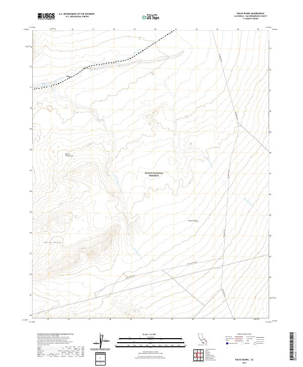
2021 Map of Kelso Dunes
USGS Topo · Published 2021About this map
Mojave National Preserve contains some of the most striking aeolian landscapes in the high desert, centered on the massive Kelso Dunes and the surrounding Mojave Desert. This 2021 survey shows a topography defined by wind and water, where drainage systems like Kelso Wash and Cottonwood Wash carve paths through the sandy terrain. The small settlement at Flynn and the crossing of Kelbaker Road provide the primary human markers in this otherwise arid expanse. The map details the transition from the shifting sands of the Devils Playground to the more stable desert flats, offering a precise view of the modern boundaries and access routes within this protected wilderness area. It is a valuable document for understanding how contemporary infrastructure and ancient geological features coexist in this corner of San Bernardino County.
Find a feature on this map
16 named features on this map. Tap any name to fly to it.
Don’t see what you’re looking for? This feature index may not catch every label — zoom into the map to look around manually.
Map Details
Editions of this 2021 Kelso Dunes Map
This is the sole edition of this map. No revisions or reprints were ever made.
Other maps of this area

1910 · Ivanpah
USGS Topo · 1:250,000

1912 · Ivanpah
USGS Topo · 1:250,000

1942 · Ivanpah
USGS Topo · 1:250,000

1942 · Amboy
USGS Topo · 1:250,000

1943 · Amboy
USGS Topo · 1:250,000

1947 · Kingman
USGS Topo · 1:250,000

1948 · Kingman
USGS Topo · 1:250,000

1954 · Needles
USGS Topo · 1:250,000

1954 · Kingman
USGS Topo · 1:250,000

1955 · Kingman
USGS Topo · 1:250,000