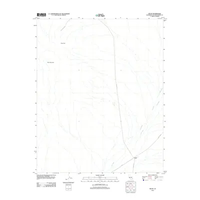
2012 Map of Kelso
USGS Topo · Published 2012About this map
Kelso serves as the central hub for this High Desert landscape, situated where the Up RR cuts across the arid basin. The settlement is positioned at the meeting point of several desert thoroughfares, including Kelbaker Rd and Kelso Cima Rd. The topography is dominated by the Kelso Mountains to the northwest, peaking at Kelso Peak, while a complex drainage system of ephemeral desert streams, notably Kelso Wash and Cedar Wash, defines the lowlands. The presence of the Utility Access Rd running through the northern reaches suggests the ongoing industrial infrastructure required to support this remote Mojave environment. This survey provides a precise look at the intersection of rail history and the natural desert terrain before the most recent decade of environmental changes.
Find a feature on this map
9 named features on this map. Tap any name to fly to it.
Don’t see what you’re looking for? This feature index may not catch every label — zoom into the map to look around manually.
Map Details
Editions of this 2012 Kelso Map
This is the sole edition of this map. No revisions or reprints were ever made.
Other maps of this area

1910 · Ivanpah
USGS Topo · 1:250,000

1912 · Ivanpah
USGS Topo · 1:250,000

1942 · Ivanpah
USGS Topo · 1:250,000

1942 · Amboy
USGS Topo · 1:250,000

1943 · Amboy
USGS Topo · 1:250,000

1947 · Kingman
USGS Topo · 1:250,000

1948 · Kingman
USGS Topo · 1:250,000

1954 · Needles
USGS Topo · 1:250,000

1954 · Kingman
USGS Topo · 1:250,000

1955 · Kingman
USGS Topo · 1:250,000