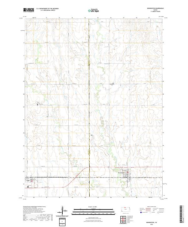
2022 Map of Kensington
USGS Topo · Published 2022About this map
Kensington and Agra anchor the southern reach of this landscape, situated along the shared boundary of Phillips Co and Smith Co. The terrain is defined by the branching tributaries of the Cedar Creek system, including Middle Cedar Cr, E Cedar Cr, and W Cedar Cr, which carve through the plains and dictate the local drainage patterns. A systematic grid of section roads, such as E Jade Rd and E Ridge Rd, organizes the agricultural spaces between these watercourses. For local history researchers, the map identifies three distinct burial sites: Germantown Cem in the north, West Cedar Cem further west, and Agra Cem near the town of the same name. These sites, along with town corridors like Railroad Ave and Kansas Ave, offer a clear picture of the region's rural infrastructure.
Find a feature on this map
37 named features on this map. Tap any name to fly to it.
Don’t see what you’re looking for? This feature index may not catch every label — zoom into the map to look around manually.
Map Details
Editions of this 2022 Kensington Map
This is the sole edition of this map. No revisions or reprints were ever made.