2022 Map of Keota
USGS Topo · Published 2022About this map
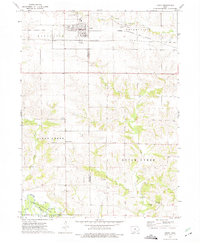
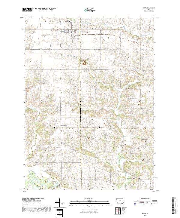
Keota and the smaller settlement of Talleyrand anchor this rural landscape along the Keokuk Co Washington Co line. The terrain is defined by a dense network of watercourses including the W Fork Crooked Cr, Dutch Cr, and Clear Cr, all eventually draining toward the Skunk River in the southwestern corner. For genealogists and local historians, this survey is particularly valuable for its high density of burial sites across the township divisions, ranging from the Keota Cem and Saint Marys Cem in the north to the Valley Cem and White Oak Cem further south. The path of the Kewash Nature Trl cuts across the northern tiers, following a legacy corridor through the prairie. The map provides a clear record of the modern rural infrastructure, showing how the secondary roads like Co Hwy G32 and Co Hwy W21 connect these agricultural communities.
Find a feature on this map
26 named features on this map. Tap any name to fly to it.
Don’t see what you’re looking for? This feature index may not catch every label — zoom into the map to look around manually.
Map Details
Editions of this 2022 Keota Map
This is the sole edition of this map. No revisions or reprints were ever made.