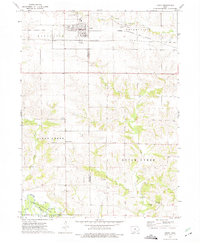
1973 Map of Keota
USGS Topo · Published 1975About this map
The town of Keota serves as the primary hub on this prairie landscape, where the Chicago Rock Island and Pacific railroad and an Old Railroad Grade suggest a shifting transportation network in the early 1970s. The northern portion of the quadrangle is marked by a large Gas Storage Area and associated Pipelines, indicating the regional importance of energy infrastructure. To the south, the terrain descends toward the Skunk River, where the Spanier Bridge Skunk River State Wildlife Area occupies the river bottomlands.
Find a feature on this map
29 named features on this map. Tap any name to fly to it.
Don’t see what you’re looking for? This feature index may not catch every label — zoom into the map to look around manually.
Map Details
Editions of this 1973 Keota Map
This is the sole edition of this map. No revisions or reprints were ever made.
Other maps of this area

1954 · Des Moines
USGS Topo · 1:250,000

1956 · Des Moines
USGS Topo · 1:250,000

1957 · Des Moines
USGS Topo · 1:250,000

1958 · Davenport
USGS Topo · 1:250,000

1961 · Davenport
USGS Topo · 1:250,000

1962 · Davenport
USGS Topo · 1:250,000

1965 · Harper
USGS Topo · 1:24,000

1965 · South English
USGS Topo · 1:24,000

1969 · Des Moines
USGS Topo · 1:250,000
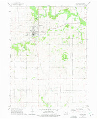
1973 · Wellman
USGS Topo · 1:24,000