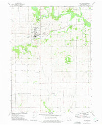
1973 Map of Wellman
USGS Topo · Published 1975About this map
The Wellman township area is defined by the winding course of the English River and its southern tributaries in the early 1970s. This agricultural landscape in Washington County is punctuated by numerous community burial sites, including the Mennonite Cem, Wassonville Cem, and Pilot Grove Cem, reflecting the deep denominational roots of the local population. While Wellman serves as the primary hub with its High Sch and organized street grid, the map also identifies the outlying hamlets of Daytonville and Lexington. Transport patterns show a transition from traditional rural routes to modern infrastructure, seen in the Wellman Municipal Airport and the operations of the Iowa Transportation Coop. The terrain remains largely dedicated to farming, with natural breaks found at the Foster Woods Park Picnic Area and small industrial sites like the Quarry near the southern boundary.
Find a feature on this map
26 named features on this map. Tap any name to fly to it.
Don’t see what you’re looking for? This feature index may not catch every label — zoom into the map to look around manually.
Map Details
Editions of this 1973 Wellman Map
This is the sole edition of this map. No revisions or reprints were ever made.
Other maps of this area

1891 · Oxford
USGS Topo · 1:62,500

1891 · Iowa City
USGS Topo · 1:62,500

1894 · Oxford
USGS Topo · 1:62,500

1903 · Fairfax
USGS Topo · 1:125,000

1938 · Iowa City
USGS Topo · 1:62,500

1958 · Davenport
USGS Topo · 1:250,000

1961 · Davenport
USGS Topo · 1:250,000

1962 · Davenport
USGS Topo · 1:250,000

1965 · Williamstown
USGS Topo · 1:24,000

1969 · Kalona
USGS Topo · 1:24,000