
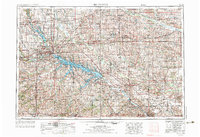
1954 Map of Des Moines
USGS Topo · Published 1973About this map
Des Moines serves as the focal point of this regional study, which captures central Iowa during a period of significant hydrological and infrastructure development. The expansion of the Des Moines River basin is prominently featured through the presence of large-scale water management projects, including Saylorville Lake and the Red Rock Reservoir. These reservoirs, along with Rathbun Lake to the south, illustrate the mid-century transformation of the Iowa landscape for flood control and recreation.
Find a feature on this map
156 named features on this map. Tap any name to fly to it.
Don’t see what you’re looking for? This feature index may not catch every label — zoom into the map to look around manually.
Map Details
Editions of this 1954 Des Moines Map
2 editions found
Other maps of this area

1888 · Shellsburg
USGS Topo · 1:62,500

1888 · Amana
USGS Topo · 1:62,500

1889 · Amana
USGS Topo · 1:62,500

1889 · Shellsburg
USGS Topo · 1:62,500

1891 · Oxford
USGS Topo · 1:62,500

1894 · Oxford
USGS Topo · 1:62,500

1899 · Amana
USGS Topo · 1:62,500

1899 · Shellsburg
USGS Topo · 1:62,500

1903 · Fairfax
USGS Topo · 1:125,000

1903 · Winthrop
USGS Topo · 1:125,000