
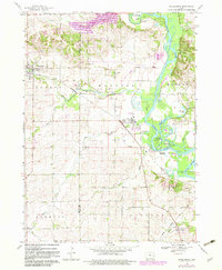
1888 Map of Shellsburg
USGS Topo · Published 1888About this map
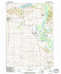
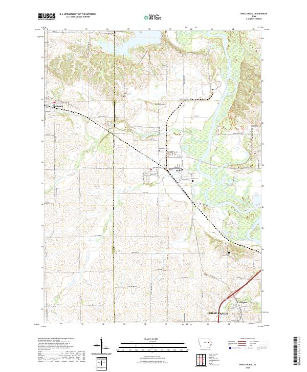
The Cedar River carves a deep, winding path through this corner of eastern Iowa, dictating the development of early Benton and Linn County settlements. The Burlington Cedar Rapids and Northern Railroad serves as the primary artery for local commerce, cutting diagonally across the landscape and connecting the grid-patterned streets of Shellsburg and Palo. This 1888 survey reveals a territory transitioning into a mature agricultural region, where townships like Canton, Fayette, and Washington are defined by an intricate network of drainage creeks such as Wild Cat Creek, Little Bear Creek, and Opossum Creek. Beyond the river valley, the terrain levels into the high ground of Urbana and Center Point, showcasing the precise rectangular land division that characterizes the late nineteenth-century Midwest. The map provides a detailed view of these rural communities just as the rail-and-river economy reached its peak.
Find a feature on this map
24 named features on this map. Tap any name to fly to it.
Don’t see what you’re looking for? This feature index may not catch every label — zoom into the map to look around manually.
Map Details
Editions of this 1888 Shellsburg Map
This is the sole edition of this map. No revisions or reprints were ever made.
Historical Maps of Cedar Rapids Through Time
10 maps found
1888 Shellsburg
Benton County, IA

1889 Shellsburg
Benton County, IA

1899 Shellsburg
Benton County, IA
1968 Shellsburg
Benton County, IA
1993 Shellsburg
Benton County, IA
2010 Shellsburg
Benton County, IA
2013 Shellsburg
Benton County, IA
2015 Shellsburg
Benton County, IA
2018 Shellsburg
Benton County, IA
2022 Shellsburg
Benton County, IA