Loading...
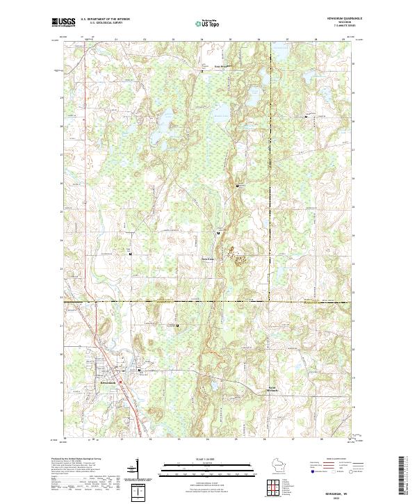
Loading map...2022 Map of Kewaskum
USGS Topo · Published 2022About this map
The glacial kettle-and-moraine topography of Washington, Fond du Lac, and Sheboygan counties is exceptionally well-defined in this contemporary survey. Central to the landscape is the Milwaukee River and its East Branch, which carve through a terrain dotted with glacial features like Mauthe Lake, Auburn Lake, and the small Mallard Hole Lake. This network of waterways and wetlands historically dictated the placement of small rural crossroads and service centers.
Find a feature on this map
114 named features on this map. Tap any name to fly to it.
Don’t see what you’re looking for? This feature index may not catch every label — zoom into the map to look around manually.
Map Details
Date Portrayed2022
Date Published2022
PublisherU.S. Geological Survey
Map TypeTopographic
Scale1:24000
Physical Dimensions24 x 29 inches
Editions of this 2022 Kewaskum Map
This is the sole edition of this map. No revisions or reprints were ever made.
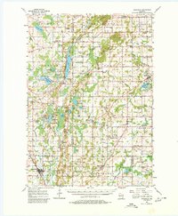
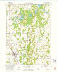
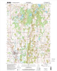
Historical Maps of Kewaskum Through Time
4 maps found
Featured Locations
Source Details
SourceU.S. Geological Survey
CopyrightPublic Domain