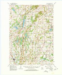
1955 Map of Kewaskum
USGS Topo · Published 1980About this map
Kettle Moraine State Forest dominates the topography of this mid-century survey, showcasing the distinctive glacial ridges and kettle depressions that define the Kettle Moraine region. The map preserves a rural landscape of four intersecting counties—Fond du Lac, Sheboygan, Washington, and Ozaukee—prior to significant suburban expansion. Small hamlets like Dundee, Beechwood, and Boltonville serve as local hubs, while numerous rural schools such as South Prairie Sch and Lyndon Mitchell Sch indicate the density of the farming community at the time.
Find a feature on this map
81 named features on this map. Tap any name to fly to it.
Don’t see what you’re looking for? This feature index may not catch every label — zoom into the map to look around manually.
Map Details
Editions of this 1955 Kewaskum Map
4 editions found

Other maps of this area

1892 · Port Washington
USGS Topo · 1:62,500

1904 · West Bend
USGS Topo · 1:62,500

1904 · Port Washington
USGS Topo · 1:62,500

1904 · Hartford
USGS Topo · 1:62,500

1910 · Fond du Lac
USGS Topo · 1:62,500

1954 · Sheboygan Falls
USGS Topo · 1:62,500

1954 · Howards Grove
USGS Topo · 1:62,500

1954 · Franklin
USGS Topo · 1:24,000

1954 · Kiel
USGS Topo · 1:62,500

1954 · Milwaukee
USGS Topo · 1:250,000