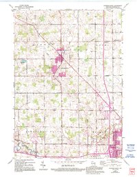
1954 Map of Howards Grove
USGS Topo · Published 1956About this map
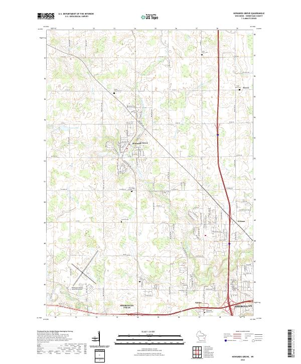
Mission House College and the Salvatorian Seminary anchor a landscape defined by small Wisconsin hamlets and dairy-country townships in the mid-1950s. The region is marked by an exceptional density of rural education and faith, featuring numerous country schools like Liberty Bell Sch and Fountain Park Sch, alongside churches such as St Johns Ch and Saron Ch. The Sheboygan River winds through the southern half of the quadrangle, passing near Johnsonville and the industrial hub of Kohler, while the Pigeon River cuts across the north. Transportation is defined by the Chicago and North Western railroad and the historic corridor of the Green Bay Road. From the glacial waters of Little Elkhart Lake to the scattered settlements of Millersville and St Wendel, this map preserves the mid-century layout of Eastern Wisconsin before modern suburban expansion reshaped the corridor between Sheboygan and Manitowoc.
Find a feature on this map
115 named features on this map. Tap any name to fly to it.
Don’t see what you’re looking for? This feature index may not catch every label — zoom into the map to look around manually.
Map Details
Editions of this 1954 Howards Grove Map
This is the sole edition of this map. No revisions or reprints were ever made.
Historical Maps of Sheboygan Through Time
7 maps found