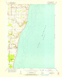
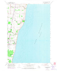
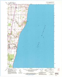
1954 Map of Cleveland
USGS Topo · Published 1956About this map
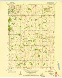
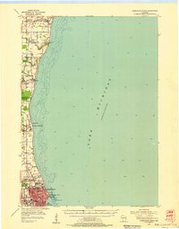
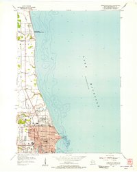
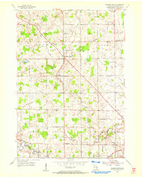
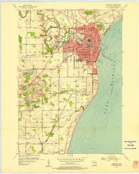
Lake Michigan's western shoreline dominates this 1954 survey, which highlights the agricultural and coastal character of the Manitowoc and Sheboygan county border. The Chicago and North Western railroad corridor serves as the primary inland artery, connecting the community of Cleveland with smaller settlements like Northeim and Hika. Local life in the townships of Newton, Centerville, and Mosel is mapped through scattered rural institutions, including the White Trail School and Kassa Cemetery. The landscape is defined by the drainage patterns of several small waterways, such as Centerville Creek and Fischer Creek, which cut through the lakeside terrain toward the shore. Of particular interest is the interplay between the coastal road network and these creeks, showing the development of this lakeside region before major modernization altered the traditional rural footprint.
Find a feature on this map
18 named features on this map. Tap any name to fly to it.
Don’t see what you’re looking for? This feature index may not catch every label — zoom into the map to look around manually.
Map Details
Editions of this 1954 Cleveland Map
3 editions found
Other maps of this area
1954 · Manitowoc
USGS Topo · 1:62,500
1954 · St. Wendel
USGS Topo · 1:24,000
1954 · Sheboygan North
USGS Topo · 1:62,500
1954 · Sheboygan North
USGS Topo · 1:24,000

1954 · Howards Grove
USGS Topo · 1:62,500
1954 · Howards Grove
USGS Topo · 1:24,000

1954 · Reedsville
USGS Topo · 1:62,500
1954 · Manitowoc
USGS Topo · 1:24,000

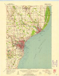
1954 · Milwaukee
USGS Topo · 1:250,000

1954 · Manitowoc
USGS Topo · 1:250,000