
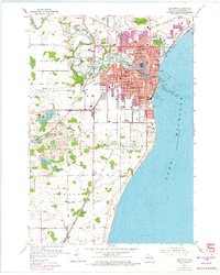
1954 Map of Manitowoc
USGS Topo · Published 1956About this map
The Manitowoc Harbor and its Turning Basin dominate the Lake Michigan shoreline of this mid-century survey, serving as the industrial and logistical heart of the city. Industrial activity and maritime infrastructure are evident in the Waterworks Intake and Intake Crib offshore, while the Chicago and North Western railroad provides land-based connectivity. The landscape is dotted with educational and social institutions, including numerous neighborhood schools like Franklin Sch and Lincoln High Sch, as well as specialized facilities such as the Holy Family Convent and the County Asylum. Outside the urban center, the terrain is defined by a series of small water bodies like Silver Lake and Hartlaubs Lake, and small rural communities including Duveneck and Alverno. The transition from urban density to rural township is marked by the Salem Sch (Aban'd) and the Town Hall in Newton.
Find a feature on this map
65 named features on this map. Tap any name to fly to it.
Don’t see what you’re looking for? This feature index may not catch every label — zoom into the map to look around manually.
Map Details
Editions of this 1954 Manitowoc Map
2 editions found
Other maps of this area

1954 · Manitowoc
USGS Topo · 1:62,500

1954 · Cleveland
USGS Topo · 1:24,000

1954 · St. Wendel
USGS Topo · 1:24,000

1954 · Sheboygan North
USGS Topo · 1:62,500

1954 · Howards Grove
USGS Topo · 1:62,500

1954 · Reedsville
USGS Topo · 1:62,500

1954 · Milwaukee
USGS Topo · 1:250,000

1954 · Manitowoc
USGS Topo · 1:250,000

1958 · Manitowoc
USGS Topo · 1:250,000

1958 · Milwaukee
USGS Topo · 1:250,000