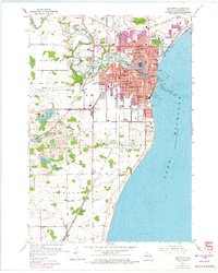
1954 Map of Manitowoc
USGS Topo · Published 1974About this map
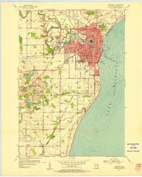
The Manitowoc River carves a winding path through this mid-century lakeshore landscape, meeting Lake Michigan at a heavily developed Harbor and Turning Basin. The city's growth is evident in its dense network of schools, including Lincoln High Sch and Wilson High Sch, alongside civic landmarks like the Municipal Airport and the County Fairground. South of the urban center, the terrain transitions into a mosaic of small lakes such as Silver Lake, Hartlaub Lake, and Kashbaum Lake, reflecting the region's glacial geography.
Find a feature on this map
60 named features on this map. Tap any name to fly to it.
Don’t see what you’re looking for? This feature index may not catch every label — zoom into the map to look around manually.
Map Details
Editions of this 1954 Manitowoc Map
2 editions found
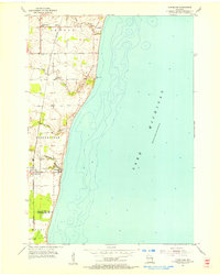
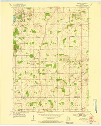
Other maps of this area
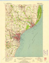
1954 · Manitowoc
USGS Topo · 1:62,500
1954 · Cleveland
USGS Topo · 1:24,000
1954 · St. Wendel
USGS Topo · 1:24,000
1954 · Sheboygan North
USGS Topo · 1:62,500

1954 · Howards Grove
USGS Topo · 1:62,500

1954 · Reedsville
USGS Topo · 1:62,500
1954 · Manitowoc
USGS Topo · 1:24,000

1954 · Milwaukee
USGS Topo · 1:250,000

1954 · Manitowoc
USGS Topo · 1:250,000

1958 · Manitowoc
USGS Topo · 1:250,000