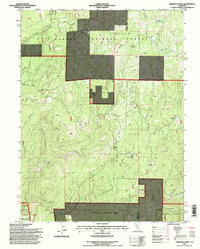
1995 Map of Kimshew Point
USGS Topo · Published 1997About this map
Lassen National Forest terrain dominates this high-altitude survey of the northern Sierra Nevada, where the border between Butte and Plumas Counties follows the ridgelines. The landscape is defined by the headwaters of Kimshew Creek, which carves through Breakneck Canyon and creates natural collection points like Ramsey Bar. Historical land use is visible in the presence of seasonal mountain outposts like Campbell Cow Camp and the high-elevation Snow Mine, reflecting the region's legacy of cattle ranching and mining.
Find a feature on this map
49 named features on this map. Tap any name to fly to it.
Don’t see what you’re looking for? This feature index may not catch every label — zoom into the map to look around manually.
Map Details
Editions of this 1995 Kimshew Point Map
This is the sole edition of this map. No revisions or reprints were ever made.
Other maps of this area

1886 · Lassen Peak
USGS Topo · 1:250,000

1888 · Bidwell Bar
USGS Topo · 1:125,000

1891 · Bidwell Bar
USGS Topo · 1:125,000

1891 · Chico
USGS Topo · 1:125,000

1892 · Lassen Peak
USGS Topo · 1:250,000

1893 · Chico
USGS Topo · 1:125,000

1893 · Bidwell Bar
USGS Topo · 1:125,000

1894 · Lassen Peak
USGS Topo · 1:250,000

1895 · Bidwell Bar
USGS Topo · 1:125,000

1895 · Chico
USGS Topo · 1:125,000