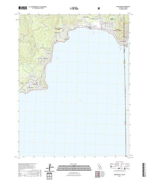
2021 Map of Kings Beach
USGS Topo · Published 2021About this map
Lake Tahoe dominates the southern half of this modern survey, its deep waters framed by the North Shore's complex network of recreational communities and mountain terrain. The residential and commercial density of Kings Beach and Tahoe Vista contrasts with the surrounding protected lands of the Tahoe National Forest and Toiyabe National Forest. The map captures the interface between shoreline access points like Patton Beach and Secline Beach and the higher elevations of Carnelian Canyon, where the Tahoe Rim Trl and Watson Creek Trl provide back-country transit. Along the western edge, the Placer County Tahoe Courthouse stands near Dollar Point and Lake Forest, while the eastern boundary traces the California Nevada state line as it cuts through Crystal Bay and the historic settlement at Brockway. Local landmarks such as Dollar Reservoir and Brockway Spring highlight the essential water resources of this high-altitude landscape.
Find a feature on this map
32 named features on this map. Tap any name to fly to it.
Don’t see what you’re looking for? This feature index may not catch every label — zoom into the map to look around manually.
Map Details
Editions of this 2021 Kings Beach Map
This is the sole edition of this map. No revisions or reprints were ever made.
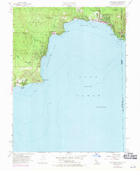
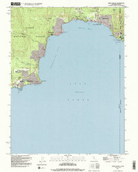
Historical Maps of Kings Beach Through Time
3 maps found