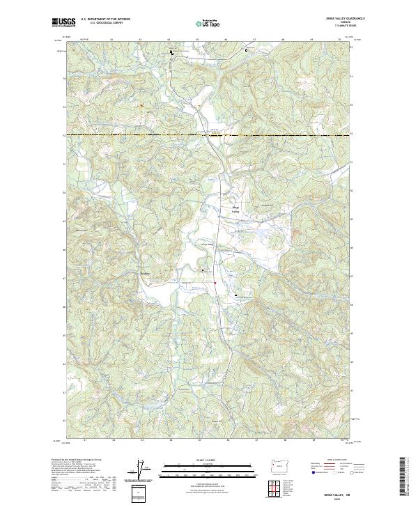
2023 Map of Kings Valley
USGS Topo · Published 2023About this map
The Luckiamute River meanders through this agricultural valley on the border of Polk and Benton Counties, anchoring a landscape shaped by early Oregon pioneers. The community of Kings Valley sits at the heart of the region, surrounded by legacy landholdings and family burial sites such as the Isaac King Family Cem and the Edwards Pioneer Cem. To the west, the settlement of Hoskins lies near the Fort Hoskins Spring, marking a site of significant mid-19th-century military history. The terrain is defined by a series of prominent rises including Burgett Hill and Bonner Mtn, which overlook a network of creeks and small impoundments like Emory Moore Reservoir and the Lake of the Winds. Local infrastructure, from Pedee Creek Rd to Maxfield Creek Rd, follows the natural contours of the valley floor, connecting scattered farmsteads and historic cemeteries that serve as vital records for genealogical research in the Willamette Valley foothills.
Find a feature on this map
66 named features on this map. Tap any name to fly to it.
Don’t see what you’re looking for? This feature index may not catch every label — zoom into the map to look around manually.
Map Details
Editions of this 2023 Kings Valley Map
This is the sole edition of this map. No revisions or reprints were ever made.
Other maps of this area

1913 · Philomath
USGS Topo · 1:31,680

1914 · Soap Creek
USGS Topo · 1:31,680

1921 · Corvallis
USGS Topo · 1:62,500

1922 · Airlie
USGS Topo · 1:31,680

1939 · Marys Peak
USGS Topo · 1:62,500

1942 · Marys Peak
USGS Topo · 1:62,500

1942 · Corvallis
USGS Topo · 1:62,500

1942 · Valsetz
USGS Topo · 1:62,500

1942 · Dallas
USGS Topo · 1:62,500

1953 · Salem
USGS Topo · 1:250,000