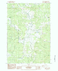
1984 Map of Kings Valley
USGS Topo · Published 1984About this map
The Luckiamute River flows through the heart of the Kings Valley, a landscape defined by its pioneer history and early timber economy. This 1984 provisional survey documents the rural character of the Polk and Benton county line, where small settlements like Hoskins and Ritner are connected by the remnants of the Old RR Grade. Local heritage is anchored by significant sites such as the Fort Hoskins (Site) and a Covered Bridge near the river. The map provides a detailed view of family-named landmarks and early infrastructure, including the Pedee Sch and several pioneer burial grounds like Edwards Cem and Warner Cem. Numerous quarries and gravel pits suggest the area's continued reliance on local natural resources, while features like the Hist Mon and Ritner Creek Park preserve the legacy of the mid-valley's settlement era.
Find a feature on this map
41 named features on this map. Tap any name to fly to it.
Don’t see what you’re looking for? This feature index may not catch every label — zoom into the map to look around manually.
Map Details
Editions of this 1984 Kings Valley Map
This is the sole edition of this map. No revisions or reprints were ever made.
Other maps of this area

1913 · Philomath
USGS Topo · 1:31,680

1914 · Soap Creek
USGS Topo · 1:31,680

1921 · Corvallis
USGS Topo · 1:62,500

1922 · Airlie
USGS Topo · 1:31,680

1939 · Marys Peak
USGS Topo · 1:62,500

1942 · Marys Peak
USGS Topo · 1:62,500

1942 · Corvallis
USGS Topo · 1:62,500

1942 · Valsetz
USGS Topo · 1:62,500

1942 · Dallas
USGS Topo · 1:62,500

1953 · Salem
USGS Topo · 1:250,000