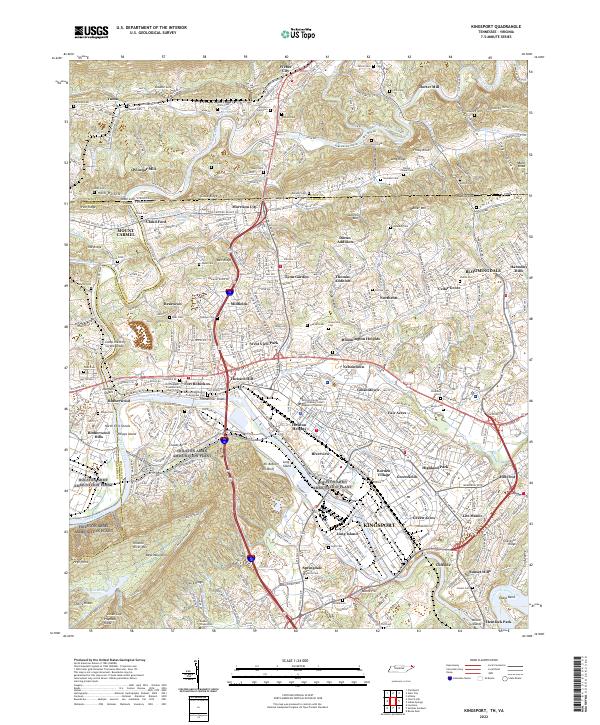
2022 Map of Kingsport
USGS Topo · Published 2022About this map
The confluence of the North Fork Holston River and South Fork Holston River anchors this detailed study of the Tennessee-Virginia borderlands. This region is defined by its complex waterway system, where Long Island and Phipps Island sit as prominent landmarks amidst the winding river channels. The map reveals a densely settled landscape of established neighborhoods like Lynn Garden, Borden Village, and Highland Park, contrasting with the more rural terrain of Bays Mountain and Walker Mtn to the north and south.
Find a feature on this map
122 named features on this map. Tap any name to fly to it.
Don’t see what you’re looking for? This feature index may not catch every label — zoom into the map to look around manually.
Map Details
Editions of this 2022 Kingsport Map
This is the sole edition of this map. No revisions or reprints were ever made.
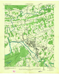
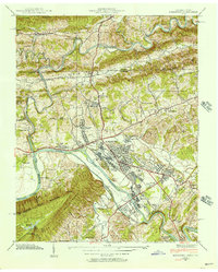
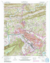
Historical Maps of East Kingsport Through Time
4 maps found