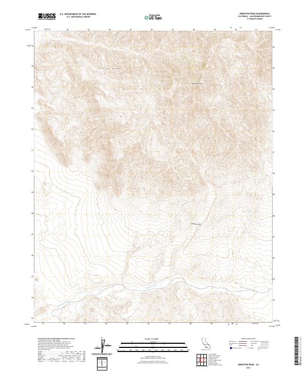
2021 Map of Kingston Peak
USGS Topo · Published 2021About this map
Kingston Peak dominates the northern skyline of this portion of the Mojave Desert, serving as a high-altitude anchor for the surrounding Kingston Range. This 2021 survey illustrates a landscape of extreme vertical relief and arid drainage systems, most notably the braided course of Kingston Wash that cuts through the southern reaches of the quadrangle. The map highlights the complex topography of the eastern California desert, where deep canyons and steep ridges transition into broad alluvial basins. The inclusion of Public Land Survey System boundaries, such as t19n r10e and t18n r9e, provides an essential framework for land managers and researchers navigating this remote desert terrain, where natural watercourses and prominent summits remain the primary landmarks.
Find a feature on this map
8 named features on this map. Tap any name to fly to it.
Don’t see what you’re looking for? This feature index may not catch every label — zoom into the map to look around manually.
Map Details
Editions of this 2021 Kingston Peak Map
This is the sole edition of this map. No revisions or reprints were ever made.
Other maps of this area

1910 · Ivanpah
USGS Topo · 1:250,000

1912 · Ivanpah
USGS Topo · 1:250,000

1933 · Avawatz Mountains
USGS Topo · 1:250,000

1942 · Ivanpah
USGS Topo · 1:250,000

1947 · Trona
USGS Topo · 1:250,000

1947 · Kingman
USGS Topo · 1:250,000

1948 · Kingman
USGS Topo · 1:250,000

1948 · Trona
USGS Topo · 1:250,000

1950 · Tecopa
USGS Topo · 1:62,500

1951 · Tecopa
USGS Topo · 1:62,500