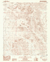
1984 Map of Kingston Spring
USGS Topo · Published 1985About this map
Kingston Spring provides a rare water source in this arid corner of the Mojave Desert, located just beneath the northern slopes of the Shadow Mountains. This 1984 provisional survey records a landscape shaped by intermittent mineral extraction and modern infrastructure, where numerous Prospect sites dot the hillsides surrounding the Eastern Star Mine. The terrain transitions from the high peaks into the broad expanse of Valjean Valley, which dominates the western half of the sheet. The mapping of the Steel Tower Transmission Line cutting across the southeastern desert floor illustrates the 20th-century utility corridor development required to bridge these remote basins. The map serves as a precise record of the road network and section lines used by surveyors and miners to navigate the steep alluvial fans and rocky outcrops of the San Bernardino County desert.
Find a feature on this map
10 named features on this map. Tap any name to fly to it.
Don’t see what you’re looking for? This feature index may not catch every label — zoom into the map to look around manually.
Map Details
Editions of this 1984 Kingston Spring Map
This is the sole edition of this map. No revisions or reprints were ever made.
Other maps of this area

1910 · Ivanpah
USGS Topo · 1:250,000

1912 · Ivanpah
USGS Topo · 1:250,000

1933 · Avawatz Mountains
USGS Topo · 1:250,000

1942 · Ivanpah
USGS Topo · 1:250,000

1947 · Trona
USGS Topo · 1:250,000

1947 · Kingman
USGS Topo · 1:250,000

1948 · Kingman
USGS Topo · 1:250,000

1948 · Trona
USGS Topo · 1:250,000

1953 · Trona
USGS Topo · 1:250,000

1954 · Kingman
USGS Topo · 1:250,000