2024 Map of Kinsman
USGS Topo · Published 2024About this map
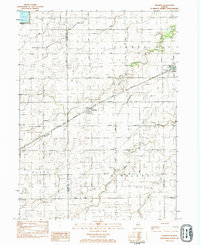
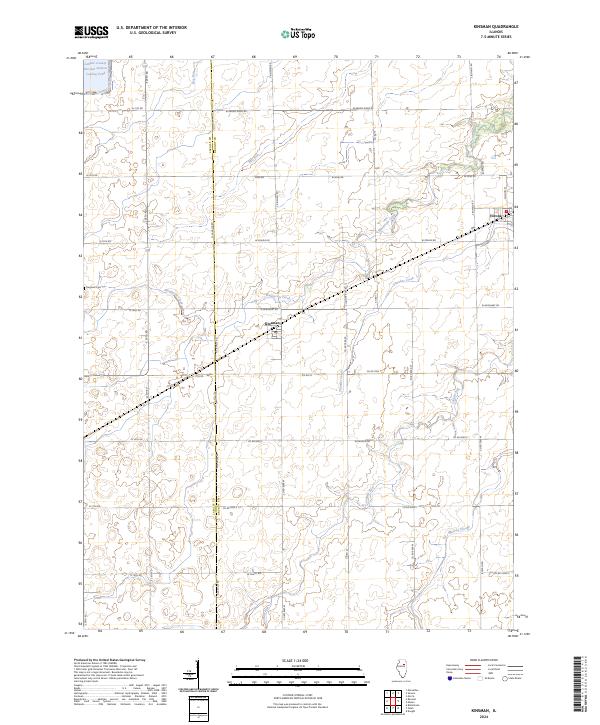
Kinsman and Verona anchor this agricultural landscape along the border of LaSalle and Grundy counties. The terrain is defined by a dense network of drainage systems, including the winding course of Waupecan Creek and Thunder Creek, which flow through the prairie towards the north. In the northwest corner, the industrial footprint of the LaSalle County Nuclear Station Cooling Pond contrasts with the surrounding rural sections. Local history is preserved at the Hegland Cem, while the town centers show established grids with essential services like the Po. A complex grid of township roads such as W Grand Ridge Rd and S Kinsman Rd segments the land into traditional square-mile sections, reflecting the enduring midwestern survey patterns that have organized this farming region for generations.
Find a feature on this map
46 named features on this map. Tap any name to fly to it.
Don’t see what you’re looking for? This feature index may not catch every label — zoom into the map to look around manually.
Map Details
Editions of this 2024 Kinsman Map
This is the sole edition of this map. No revisions or reprints were ever made.