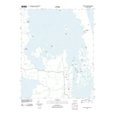
2010 Map of Knotts Island
USGS Topo · Published 2010About this map
Knotts Island anchors this coastal survey, where a complex network of marshes, islands, and narrow channels defines the boundary between the Back Bay and the Atlantic Ocean. The settlement pattern is largely shaped by the aquatic landscape, centered around the Knotts Island Post Office and the small community at Woodleigh. Local roads like Knotts Island Rd and Island Bay Ln provide the primary terrestrial connections through the low-lying peninsula, while numerous points of access such as Public Landing, False Cape Landing, and Campbells Landing emphasize the historical importance of water-based transport and fishing.
Find a feature on this map
52 named features on this map. Tap any name to fly to it.
Don’t see what you’re looking for? This feature index may not catch every label — zoom into the map to look around manually.
Map Details
Editions of this 2010 Knotts Island Map
This is the sole edition of this map. No revisions or reprints were ever made.
Other maps of this area

1893 · Virginia Beach
USGS Topo · 1:125,000

1916 · Back Bay
USGS Topo · 1:62,500

1939 · Moyock
USGS Topo · 1:62,500

1940 · Barco
USGS Topo · 1:62,500

1943 · Back Bay
USGS Topo · 1:62,500

1946 · Moyock
USGS Topo · 1:62,500

1946 · Eastville
USGS Topo · 1:250,000

1946 · Currituck Sound
USGS Topo · 1:250,000

1948 · Elizabeth City
USGS Topo · 1:62,500

1953 · Norfolk
USGS Topo · 1:250,000