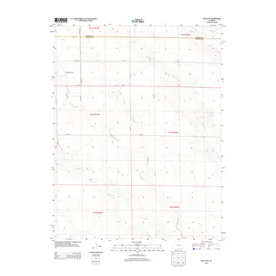
2013 Map of Kutch SW
USGS Topo · Published 2013About this map
High Mesa Airport sits atop the high plains landscape of the western Great Plains, where the drainage systems of Horse Cr and Little Horse Cr begin their descent toward the southeast. This 2013 survey of the borderlands between Elbert County and Lincoln County reveals a highly structured rural grid, defined by the Public Land Survey System and maintained through a network of section-line roads like CO Road 2A and CO Road 7. The hydrology is dominated by the ephemeral Steels Fork and its East Branch, which carve subtle paths through the terrain. The presence of a private landing strip amidst such sparse settlement highlights the vast distances of the eastern Colorado plains, where air travel and a strictly rectilinear road system connect remote ranching interests.
Find a feature on this map
22 named features on this map. Tap any name to fly to it.
Don’t see what you’re looking for? This feature index may not catch every label — zoom into the map to look around manually.
Map Details
Editions of this 2013 Kutch SW Map
This is the sole edition of this map. No revisions or reprints were ever made.
Other maps of this area

1889 · Sanborn
USGS Topo · 1:125,000

1891 · Sanborn
USGS Topo · 1:125,000

1893 · Sanborn
USGS Topo · 1:125,000

1893 · Big Springs
USGS Topo · 1:125,000

1954 · Lamar
USGS Topo · 1:250,000

1954 · Pueblo
USGS Topo · 1:250,000

1957 · Pueblo
USGS Topo · 1:250,000

1958 · Pueblo
USGS Topo · 1:250,000

1958 · Lamar
USGS Topo · 1:250,000

1962 · Pueblo
USGS Topo · 1:250,000