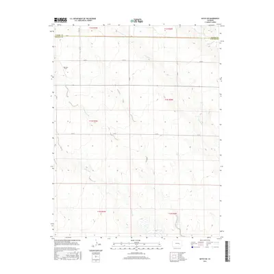
2016 Map of Kutch SW
USGS Topo · Published 2016About this map
Steels Fork and its tributaries, including E Br Steels Fork and Little Horse Cr, carve subtle drainage patterns across this High Plains landscape. The area is defined by its vast agricultural grid and the sparse infrastructure typical of the Colorado eastern plains, where the border between Elbert Co and Lincoln Co marks the eastern edge of the sheet. Modern transport is represented by the isolated High Mesa Airport, which serves this remote ranching region. The network of county roads, such as Co RD 2 and Co RD X, provides the primary structure for movement between section lines, while Horse Cr flows through the northeastern corner, indicating the vital role of water in this semi-arid environment.
Find a feature on this map
21 named features on this map. Tap any name to fly to it.
Don’t see what you’re looking for? This feature index may not catch every label — zoom into the map to look around manually.
Map Details
Editions of this 2016 Kutch SW Map
This is the sole edition of this map. No revisions or reprints were ever made.
Other maps of this area

1889 · Sanborn
USGS Topo · 1:125,000

1891 · Sanborn
USGS Topo · 1:125,000

1893 · Sanborn
USGS Topo · 1:125,000

1893 · Big Springs
USGS Topo · 1:125,000

1954 · Lamar
USGS Topo · 1:250,000

1954 · Pueblo
USGS Topo · 1:250,000

1957 · Pueblo
USGS Topo · 1:250,000

1958 · Pueblo
USGS Topo · 1:250,000

1958 · Lamar
USGS Topo · 1:250,000

1962 · Pueblo
USGS Topo · 1:250,000