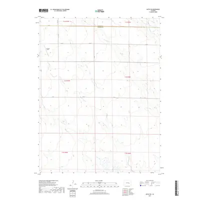
2019 Map of Kutch SW
USGS Topo · Published 2019About this map
The High Plains of eastern Colorado converge at the border of Elbert and Lincoln counties in this survey. The landscape is defined by the braided drainage systems of Steels Fork and its eastern tributary, E Br Steels Fork, which cut through the open range. In the northwest corner, the High Mesa Airport serves as a lone aeronautical landmark in an otherwise vast expanse of agricultural sections and township boundaries. These watercourses, including Little Horse Cr and Horse Cr, provide the primary relief in the terrain, guiding the placement of the sparse rural road network. The section lines of t14s r59w and surrounding townships are traced by unpaved routes such as Co Rd 2 and Co Rd X, marking the enduring grid of the American West as it appeared in the early 21st century.
Find a feature on this map
20 named features on this map. Tap any name to fly to it.
Don’t see what you’re looking for? This feature index may not catch every label — zoom into the map to look around manually.
Map Details
Editions of this 2019 Kutch SW Map
This is the sole edition of this map. No revisions or reprints were ever made.
Other maps of this area

1889 · Sanborn
USGS Topo · 1:125,000

1891 · Sanborn
USGS Topo · 1:125,000

1893 · Sanborn
USGS Topo · 1:125,000

1893 · Big Springs
USGS Topo · 1:125,000

1954 · Lamar
USGS Topo · 1:250,000

1954 · Pueblo
USGS Topo · 1:250,000

1957 · Pueblo
USGS Topo · 1:250,000

1958 · Pueblo
USGS Topo · 1:250,000

1958 · Lamar
USGS Topo · 1:250,000

1962 · Pueblo
USGS Topo · 1:250,000